How Did Humans Learn to Navigate at Sea? From Celestial Navigation to Satellite Positioning | Hamburg, Berlin & Dresden
The Ocean Has No Roads
The ocean has no roads, no signposts and no fixed landmarks. Once a ship leaves the familiar coastline behind, how can its crew know where they are? This question accompanied me through three German museums: the International Maritime Museum in Hamburg, the Deutsches Technikmuseum in Berlin and the Verkehrsmuseum Dresden. During my visits in September 2026, I encountered historical instruments, navigational records and modern positioning technologies that revealed how humanity gradually learned to transform the vast ocean into a measurable space.
In Hamburg, a wooden sextant demonstration invited visitors to measure the angle between the Sun and the horizon. In Berlin, marine chronometers and a nautical almanac explained how time became essential to determining longitude. In Dresden, historical records showed how a ship’s position, speed and weather conditions could be documented during a voyage. Together, these exhibits told a story not simply of technological invention, but of human curiosity, observation and the persistent desire to know where we are.
The ocean never refused humanity. It simply remained silent, while generations of navigators gradually covered its vastness with coordinates.
Reading the Sky: From Stars to Sextants
Long before satellite navigation, sailors depended on the natural world. They observed the Sun during the day and the stars at night, learning to recognise patterns that could guide them across open water. In the Northern Hemisphere, Polaris provided a particularly useful reference. Its height above the horizon is closely related to the observer’s latitude, allowing navigators to estimate how far north or south they had travelled.
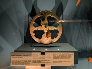
Over time, observation became measurement. Instruments such as the marine astrolabe helped sailors measure the altitude of celestial bodies. At the Deutsches Technikmuseum, I encountered a Huelva marine astrolabe dating to around 1600. Its metal structure reflected the practical difficulties of measuring angles aboard a moving vessel, where wind and waves could disturb even the most careful observations.
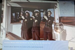
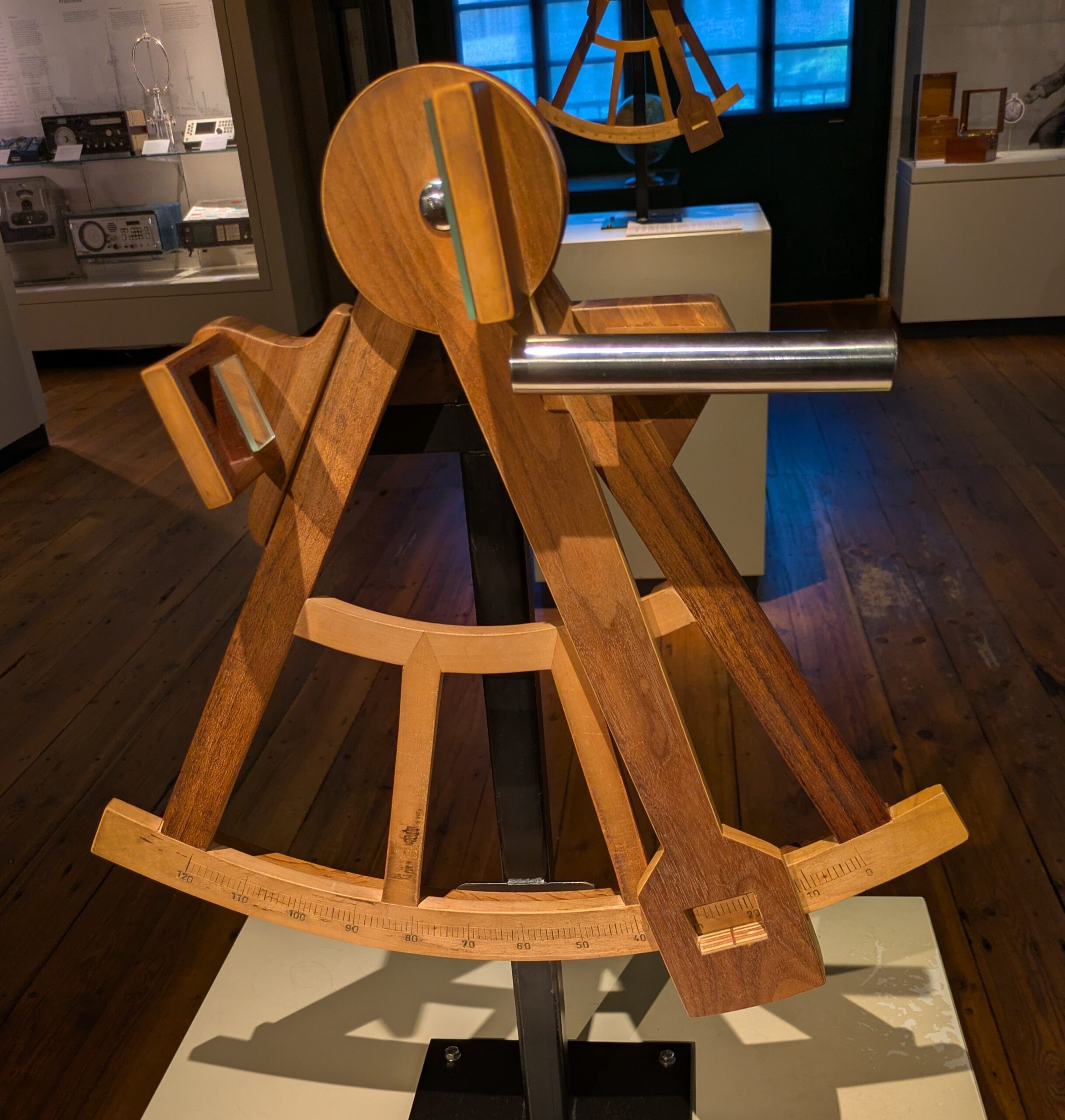
The sextant represented another important development. By using mirrors to bring the image of the Sun towards the visible horizon, navigators could measure its altitude with greater precision. In Hamburg, a hands-on demonstration made this principle understandable, while a historical photograph displayed in Dresden showed three nautical officers using sextants aboard a ship. The photograph brought the instrument back into its working environment: not a silent museum cabinet, but a moving deck where observation required patience and skill.
Human beings had no wings, yet with a mirror and a graduated scale, they found a way to bring the sky down to the horizon.
A sextant, however, does not directly reveal a ship’s position. Its measurements must be combined with astronomical information and calculations, including corrections for observational errors. Latitude gradually became easier to determine, but longitude remained a much more difficult problem.
Carrying Time Across the Sea: The Longitude Problem
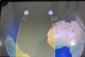
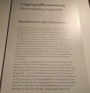
At sea, knowing the time can also mean knowing something about location. Because the Earth rotates through approximately 360 degrees in 24 hours, a difference of one hour between two places corresponds to about 15 degrees of longitude. If it is noon aboard a ship while the reference location is already at three in the afternoon, the difference represents approximately 45 degrees of longitude.
But how could a navigator know the time at a distant reference location after spending weeks or months at sea? The exhibitions in Hamburg and Berlin presented two historical approaches. One used the changing position of the Moon relative to stars, comparing observed angular distances with astronomical tables. The other relied on accurate marine chronometers capable of preserving reference time despite the movement and changing conditions aboard a ship.
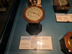
The English clockmaker John Harrison devoted years to developing reliable marine timekeepers, while John Arnold contributed to the further refinement of precision chronometers. In Berlin, a historical marine chronometer demonstrated how a seemingly ordinary object could become an instrument for measuring geographical position.
A clock was no longer merely a vessel for passing hours. It had become a ruler for measuring the Earth.
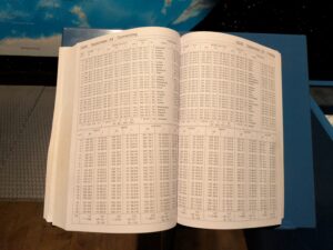
Another exhibit in Berlin particularly caught my attention: the Nautisches Jahrbuch 2026, a modern nautical almanac containing astronomical data for celestial navigation. Even in an age of satellite positioning, the movement of the Sun, Moon and stars continues to be recorded in tables that navigators can consult.
One sentence from the Berlin exhibition captured the significance of this development: Raum konnte über Zeit bestimmt werden — space could be determined through time. Once navigators learned to connect accurate timekeeping with longitude, the ocean gradually became a space that could be measured, calculated and represented on maps.
From Logbooks to Satellites: Giving the Ocean Coordinates
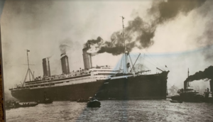
At the Verkehrsmuseum Dresden, a historical ship’s log associated with the Europa in 1936 revealed another aspect of navigation. It recorded information such as geographical position, speed and weather conditions during a voyage. These figures may appear unremarkable, yet they preserve the traces of a ship’s actual journey. A logbook records where a vessel has travelled, while a nautical chart helps navigators decide where it should go next.
Navigation also required reliable guidance when the coastline disappeared into darkness or fog. At the Deutsches Technikmuseum, I encountered a remarkable sequence of maritime technologies: lighted buoys, underwater bells, radio direction-finding equipment and satellite receivers. Each represented a different response to the same problem of uncertainty.
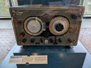
A red lighted buoy from around 1900 demonstrated how artificial markers could guide vessels through difficult waters. An underwater bell dating to around 1910 showed how sound could provide navigational information when visibility was poor. Later, radio direction-finding equipment enabled navigators to determine the direction of signals from transmitters they could not see.
Humanity illuminated the sea not to conquer its darkness, but to establish a recognisable signal within the unknown.
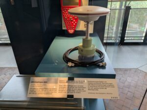
Satellite navigation transformed this process once again. In Berlin, a GPS receiver from 2003 illustrated how signals transmitted from satellites could be used to calculate distances and determine geographical position. Modern electronic charts can combine this information with detailed maritime data, allowing navigators to see their vessel’s position directly on a screen.
Yet the apparent simplicity of that screen conceals a complex technological system. Satellite signals may be disrupted, receivers may fail and displayed positions may be unreliable. The more convenient navigation becomes, the more important it is to understand what lies behind the numbers.
When we depend increasingly on coordinates displayed on a screen, do we still remember how to look towards the sky when the signal disappears?
The Sky Has Never Left the Sea
For centuries, navigators stood on moving decks and studied the Sun, Moon and stars. Later, they measured celestial angles with sextants, carried accurate time across the ocean and recorded their observations in logbooks. Today, satellites continuously transmit signals from above the Earth, making positioning faster and more accessible than previous generations could have imagined.
The instruments have changed, and so has the speed of calculation. Yet the fundamental human need to find direction remains. Technology can tell us where we are, but it cannot always tell us where we ought to go.
The sea does not offer directions on its own. Meaningful direction still depends on people willing to observe, think, question and make decisions.
Across Civilizations
From the Stars Above Chu to the Oceans of the World
At the International Maritime Museum in Hamburg, King Kaolie of Chu stopped before a sextant. He examined its mirrors and graduated scale before turning to Huang Xie, his chief minister.
“Lord Chunshen,” he asked, “is this instrument meant for looking at the Sun? Why would anyone need a mirror just to do that?”
Huang Xie smiled. “Your Majesty, navigators use it to measure the Sun’s height above the horizon. When the sea offers no signposts, they look towards the sky for guidance.”
The king considered this and turned towards me. “Lady Lingyin, we people of Chu also observed the Sun, Moon and stars. Qu Yuan questioned the origins of heaven and Earth in his Tianwen, or Questions to Heaven. Are people still searching the sky for answers more than two thousand years later?”
“Your Majesty,” I replied, “the people of Chu observed the heavens to understand the natural world and the passage of time. Navigators measured celestial bodies to determine where their ships were. Their questions were different, but they shared something important: the willingness to observe, think and question what they did not yet understand.”
Later, at the Deutsches Technikmuseum in Berlin, the king stopped before a marine chronometer. “Lady Lingyin, if the Sun is already in the sky, why must sailors carry a clock? Are captains afraid of missing dinner?”
I laughed. “Your Majesty, by comparing local time with the time at a distant reference location, navigators could calculate longitude. A clock could help them discover where they were at sea.”
The king stared in astonishment. “Time can tell people where they are? I thought its main purpose was to remind us when to eat!”
Huang Xie bowed with a smile. “Your Majesty, you use time to organise court affairs, while captains use it to find their way across the ocean. The same clock can serve very different purposes.”
Then the king noticed a satellite navigation display. “If a screen can now tell a captain exactly where the ship is, does anyone still need to look at the stars?”
I thought for a moment. “Your Majesty, technology makes navigation easier, but it cannot replace every human judgement. If the screen fails, we should at least understand where else to seek an answer.”
Huang Xie added quietly, “Your Majesty, knowing where you are and knowing where you should go are two different things. Instruments may help with the first. The second still requires a decision.”
More than two thousand years ago, the people of Chu recorded celestial observations and reflected upon the order of heaven and Earth. Today, humanity uses mathematics, precision clocks and satellites to determine positions across the oceans. These are different intellectual traditions, not a single continuous history of navigation. Yet both reveal something deeply human: a curiosity that refuses to disappear in the face of the unknown.
The stars have not answered every human question, and the sea has never willingly surrendered all its secrets. What gradually gave the world its coordinates was the determination of people who continued to observe, measure and ask questions.
As we left the exhibition, I looked back once more at the historical instruments. I knew I would continue visiting museums, discovering unfamiliar objects and asking why they had been invented. For me, finding direction has never been only about navigation. It is also a way of remaining curious about the world, even after travelling through many years of life.

 时间与行程:2026年09月02日于汉堡 · 国际海事博物馆、2026年09月24日柏林 · 德意志科技博物馆、 2026年09月25日德勒斯登 · 交通博物馆